This is a route that allows hikers to enjoy the environment and visit the three hermitages that form part of Olesa’s cultural heritage. The hike begins at the Plaça de Fèlix Figueras i Aragay. From here, we head out of the municipality along the streets Carrer de Josep Anselm Clavé, Avenida Francesc Macià, Carrer Joaquim Font (in the Cal Vicentó residential area) and Camí de les Rubiroles. Upon arriving at the paved curve in the Ribes Blaves residential area, we will continue downhill passing close by the Can Matetas farmhouse (now closed) until we reach the stream.
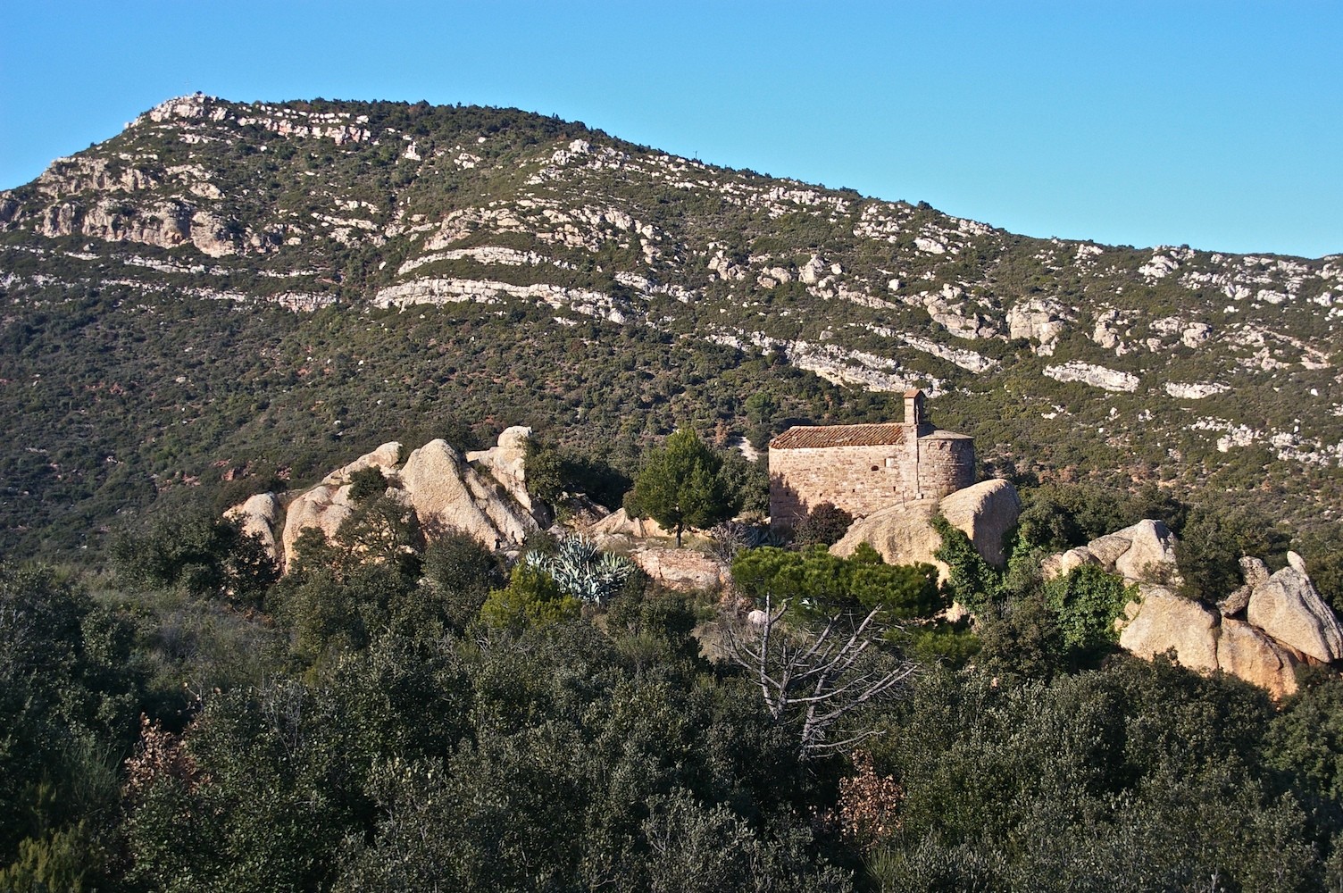
We follow the stream northward, passing under the escarpment of the Sant Jaume farmhouse. On the forest track that crosses the stream, we take the path on the right that leads up to the Sant Jaume farmhouse and hermitage (Hermitage 1). From here, we follow the forest path for 1.2 km to the Ribes Blaves residential area. On the asphalted track, we turn to the right and descend to the geological outcrop of Ribes Blaves and Highway B-120, which we will follow north for 200 meters. It is important to go carefully here, as it is a dangerous stretch.
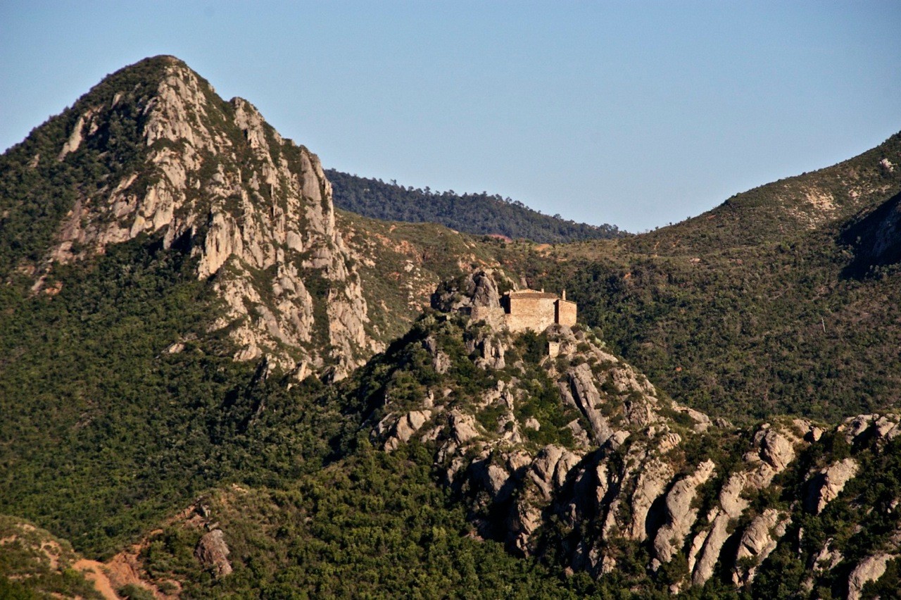
Passing the curve, we take the forest track leading toward Sant Pere Sacama to the northeast. A little later, at a fork in the road, we turn to the right and, keeping to the path, in about 15 minutes we will be able to visit the second hermitage on the route, the Sant Pere. Just ahead, a descent leads to the Mas Vilar and, at an intersection, on the leveled area below we will head toward Puigventós and the Saba Cross, the highest point in Olesa. This is a moment to enjoy the views before continuing on the route, which will take us downhill to the Puigventós farmhouse.
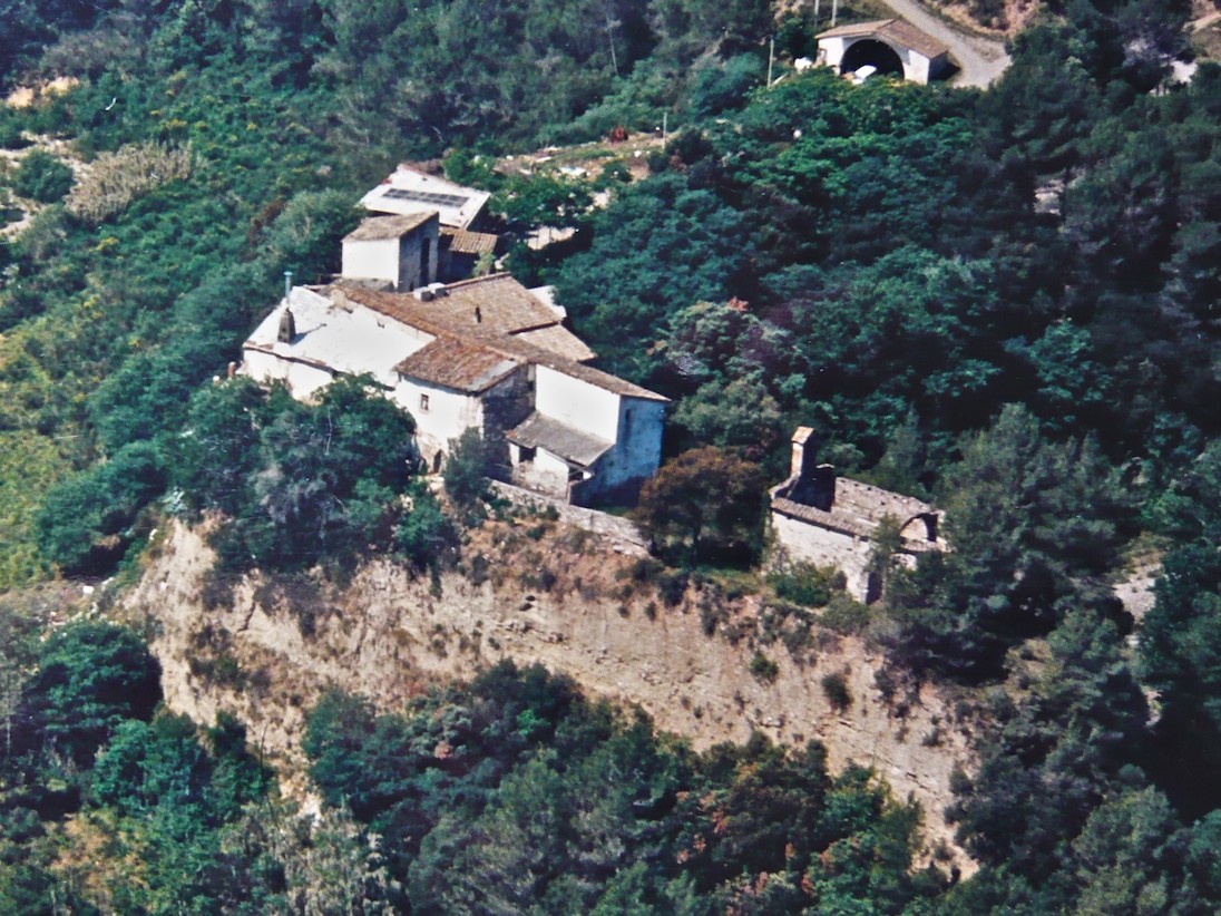
From here, a path leads to the El Fideuer plain, passing by two rural fountains: the Mateu fountain and the La Pastora fountain. Once in the plain, we take the path toward the third hermitage on the route, the Sant Salvador de les Espases hermitage. From the last vestiges of what was once a castle, we will descend to La Puda de Montserrat Spa to complete the circular route. After passing Les Espases de Sant Salvador—various pointed rock formations of quartz-pebble conglomerate—and before crossing the train tracks, we will see a path that leads to the left in a southerly direction to Olesa de Montserrat. The climb, for around 10 minutes, is hard, but after that the road flattens out until it enters the municipality.
Descending, we reach the Beca Cross. Now inside the urban area, we cross the streets of the Les Planes residential area (Urgell, Bages and Conflent) to the Santa Oliva Gate. From here, we continue along Carrer Creu Real and Carrer Ample, Plaça de Les Fonts, and Carrer de Salvador Casas, to end our journey back in Plaça de Fèlix Figueras i Aragay.
(Route created by Joan Soler Gironès - Hiking Guide for Olesa de Montserrat and environs)
Difficulty
High
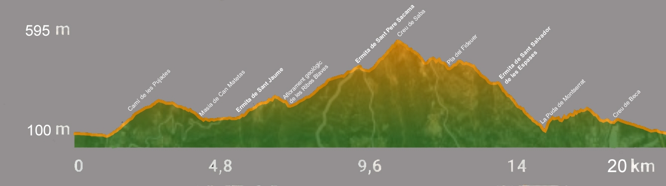
Distance
20 km
Average Duration
5.5 hours
OLESA TOURISM
Olesa de Montserrat is a municipality rich in culture and tradition, located in the foothills of the mountain of Montserrat. Olesa de Montserrat is located in the north of the comarca (county) of Baix Llobregat, in the subcomarca of Montserratí, halfway between Barcelona and the Montserrat Monastery. The natural area of the municipality, with its beautiful and magnificent scenery, is bounded by the Llobregat river and the mountain chains of Sant Salvador de les Espases and Puigventós. Olesa’s roots are markedly agricultural; it is noted in particular for its cultivation of olives of the palomar or Olesan variety, native to the region, from which the famous Olesan oil is extracted.
NEWSLETTER
CONTACT US
CAL RAPISSA - CARRER AMPLE, 25 08640 OLESA DE MONTSERRATFOLLOW US


© 2017 TURISME D’OLESA